

Andringitra is one of the most breathtaking sites in the Haute-Matsiatra region of southeastern Madagascar. It’s famous for its national park and massif, two natural treasures that attract camping and nature enthusiasts, as well as hikers and adventurers from all over the world. In this article, we’ll share everything you need to know about this famous destination in southeastern Madagascar.
Discover Andringitra national park :
Covering an area of 31,160 ha, Andringitra National Park, established in 1999, lies around 140 km from the Tropic of Capricorn. It is one of six parks listed as World Heritage Sites for the forests of the Atsinanana region in 2007. The park is a terrestrial World Heritage Site, a refuge for the plants and animals of Madagascar’s Middle East forest massif, comprising lowland forests, mountain forests, and mountain meadows, and is home to 14 species of lemur and populations of Ravenea glauca palms.
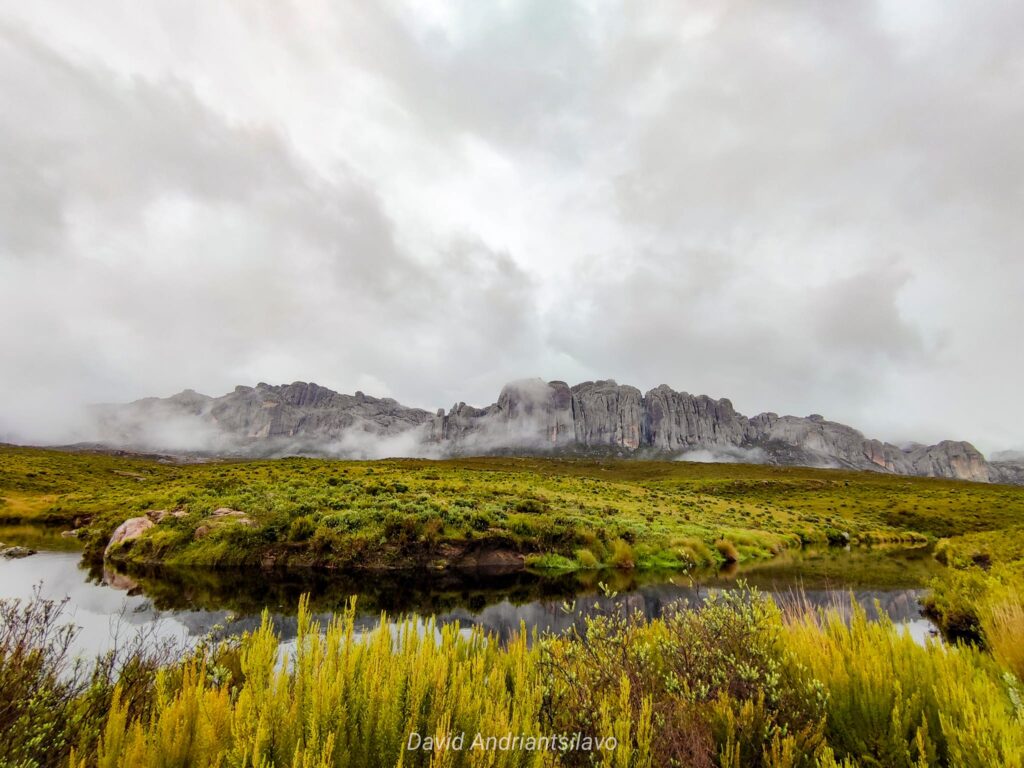
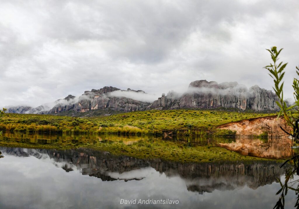
Andringitra National Park clings to the Andringitra Massif at an altitude between 650 and 2,658 meters. Andringitra is one of Madagascar’s biological hotspots, a natural laboratory where ancient relic species and more recent species coexist, giving the fauna and flora their unique characteristics.
Andringitra even boasts the highest concentration of known lemur species: 14 species in total, with no less than 9 on the eastern slope and 5 on the western slope. Carnivores are represented by 5 species, including the fosa with its miniature puma-like appearance, and birds by 106 species.
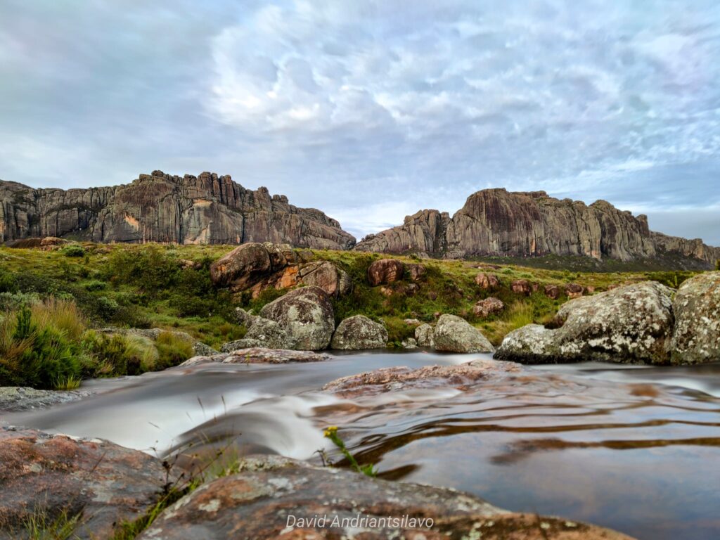
On the west face of the park, the Tsaranoro cliff is a world-renowned climbing spot. Pic Boby is Madagascar’s second-highest peak, standing at 2,658 meters.
The flora of Andringitra National Park includes 850 plant species currently identified within its boundaries. Vegetation varies: dense and humid forests at low to medium altitudes, while mountainous areas feature the most intriguing flora, with small, branched trees showing a tendency toward sclerophyllous growth.
The Andringitra massif :
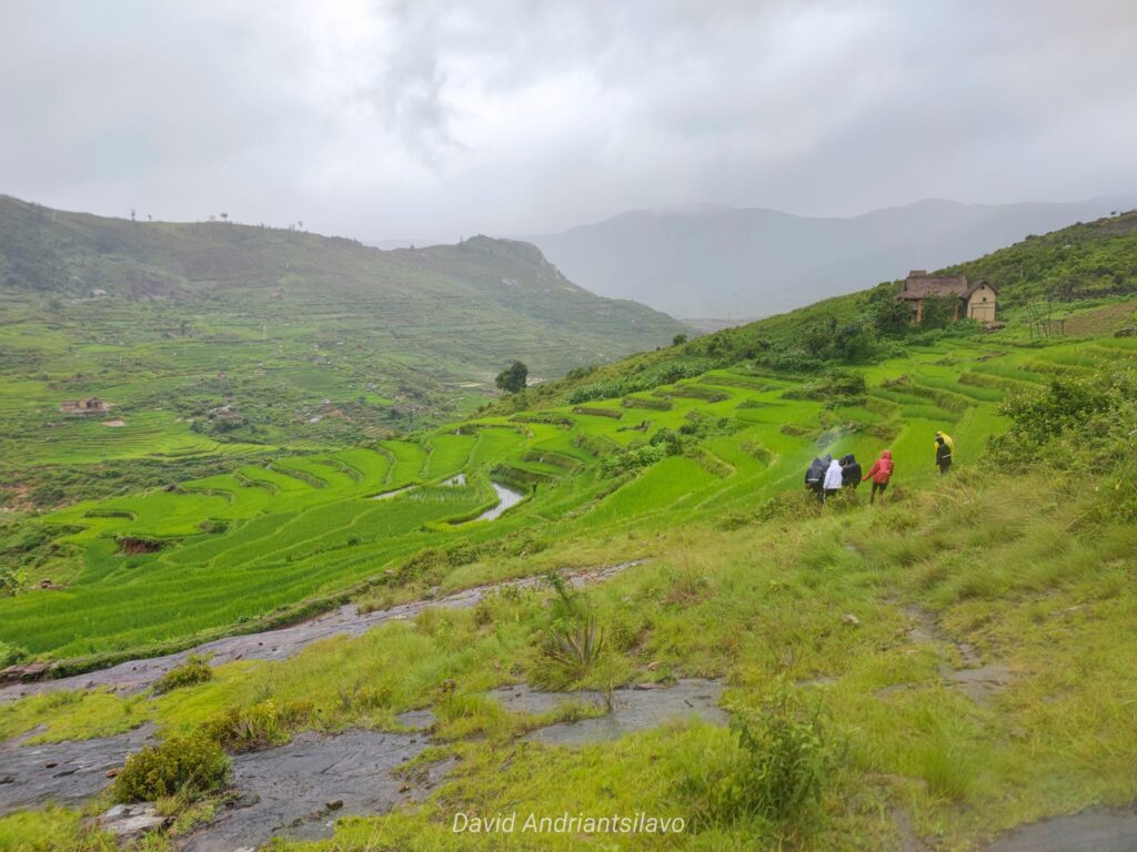
The Andringitra Massif is a superb granite and gneiss formation, perfect for long walks, adventurous climbing, and encounters with the Betsileos and Baras who inhabit the surrounding villages. The authenticity of this region is exceptionally preserved.
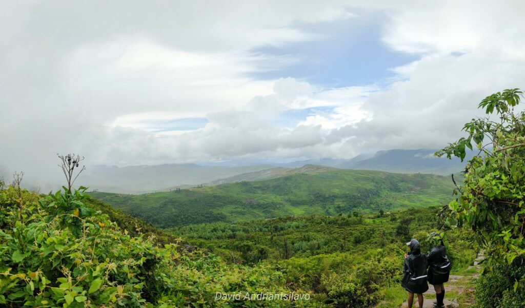
Local guides are essential for trekking in the massif and mandatory if you plan to venture into the park. Guides are readily available at all nearby accommodations, including those in the Tsaranoro Valley.
The massif enjoys a typical high-altitude tropical climate. The coldest temperatures range from -7°C in June and July to 25°C. Between May and August, temperatures can drop below 0°C. Rainfall occurs between December and February-March.
Madagascar National Parks (MNP) has set up camping sites throughout the park. There are five along your hiking trails, all equipped with dry toilets and washing facilities, but no showers. We recommend bringing good walking shoes, a hat, and warm, waterproof clothing. Please note that collecting firewood inside the park is prohibited, except from authorized vendors.
How to get to the Andringitra massif :
There are two ways to reach the Andringitra Massif: via the Namoly Valley or the Tsaranoro Valley.
If you choose the Namoly Valley route, there is a national park entrance 43 km from Ambalavao, approximately a 3-hour drive, located 4 km before the village of Ambalamanandray. It’s advisable to rent a 4×4 vehicle, as bush cabs are scarce from Ambalavao, which could result in significant time loss. For those not yet prepared to climb Pic Boby, the Tsaranoro Valley serves as a more diverse and suitable base camp, offering a variety of hiking trails.
Crossing the Tsaranoro Valley : Approximately 35 km south of Ambalavao on Route Nationale 7, look for a track indicated by a sign on the left. There are about 20 km remaining to reach the massif, so plan around 2h30 for this journey. Unlike the Namoly Valley, with a bit of luck, you can catch a taxi to the village of Vohitsaoka, located 10 km before the accommodations, operating from Monday to Saturday. From there, you can proceed on foot (a 2-hour walk) or arrange for a private taxi-brousse. Alternatively, you can plan a private 4×4 transfer from either Ambalavao or Vohitsaoka.
What you can do there :
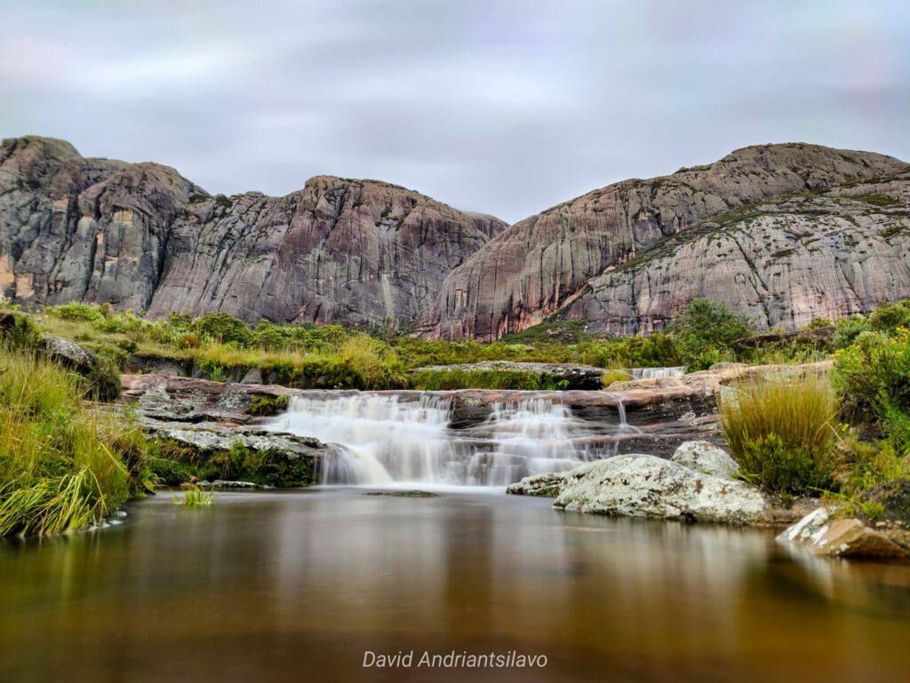
Several circuits criss-cross the park, ranging from 4 hours to a full day. Highlights include a sacred 300 m waterfall, lunar landscapes, primary rainforests with lemurs, plateaus adorned with rare palm trees, natural swimming pools, and breathtaking sunsets… The options are diverse!
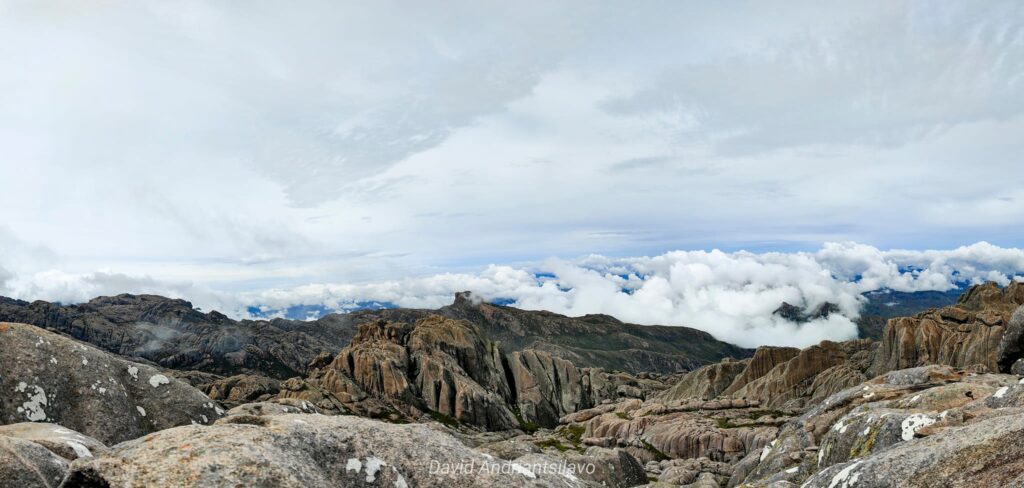
Pic Boby or Pic Imarivolanitra, meaning “close to heaven,” stands as Madagascar’s highest accessible summit. Its westernized name derives from the first group of geologists to summit in 1956… accompanied by their dog, Boby. The recommended approach to the massif is from the north face, offering a panoramic view of the entire valley, especially stunning at sunrise.